


Benton County PUMA, Arkansas
About
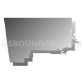
Outline

Summary
| Unique Area Identifier | 192182 |
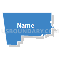
| Name | Benton County PUMA |
| State | Arkansas |
| Area (square miles) | 883.91 |
| Land Area (square miles) | 847.36 |
| Water Area (square miles) | 36.55 |
| % of Land Area | 95.87 |
| % of Water Area | 4.13 |
| Latitude of the Internal Point | 36.33782460 |
| Longtitude of the Internal Point | -94.25618710 |
Maps


Graphs
Select a template below for downloading or customizing gragh for Benton County PUMA, Arkansas


Neighbors
Neighoring Public Use Microdata Area (by Name) Neighboring Public Use Microdata Area on the Map
- Baxter, Boone, Carroll, Marion, Madison, Newton & Searcy Counties PUMA, AR
- Cherokee, Sequoyah & Adair Counties PUMA, OK
- Northeast Oklahoma PUMA, OK
- Taney, Barry, Stone & McDonald Counties PUMA, MO
- Washington County PUMA, AR
Top 10 Neighboring County (by Population) Neighboring County on the Map
- Benton County, AR (221,339)
- Washington County, AR (203,065)
- Delaware County, OK (41,487)
- Barry County, MO (35,597)
- Carroll County, AR (27,446)
- McDonald County, MO (23,083)
- Adair County, OK (22,683)
- Madison County, AR (15,717)
Top 10 Neighboring County Subdivision (by Population) Neighboring County Subdivision on the Map
- Springdale township, Washington County, AR (66,328)
- Township 9, Benton County, AR (31,362)
- Township 4, Benton County, AR (25,596)
- Grove CCD, Delaware County, OK (21,001)
- Township 7, Benton County, AR (20,317)
- Township 3, Benton County, AR (20,037)
- Township 10, Benton County, AR (16,402)
- Township 12, Benton County, AR (15,158)
- Township 2, Benton County, AR (14,279)
- Township 6, Benton County, AR (14,033)
Top 10 Neighboring Place (by Population) Neighboring Place on the Map
- Springdale city, AR (69,797)
- Rogers city, AR (55,964)
- Bentonville city, AR (35,301)
- Bella Vista town, AR (26,461)
- Siloam Springs city, AR (15,039)
- Centerton city, AR (9,515)
- Lowell city, AR (7,327)
- Pea Ridge city, AR (4,794)
- Gentry city, AR (3,158)
- Little Flock city, AR (2,585)
Top 10 Neighboring Elementary School District (by Population) Neighboring Elementary School District on the Map
Top 10 Neighboring Unified School District (by Population) Neighboring Unified School District on the Map
- Springdale School District, AR (90,624)
- Rogers Public Schools, AR (81,256)
- Bentonville Public Schools, AR (74,655)
- Siloam Springs Schools, AR (21,753)
- McDonald County R-I School District, MO (18,808)
- Grove Public Schools, OK (17,261)
- Gravette School District, AR (14,719)
- Huntsville School District, AR (14,572)
- Jay Public Schools, OK (9,476)
- Prairie Grove School District, AR (9,100)
Top 10 Neighboring State Legislative District Lower Chamber (by Population) Neighboring State Legislative District Lower Chamber on the Map
- State House District 94, AR (48,316)
- State House District 99, AR (47,695)
- State House District 98, AR (40,678)
- State House District 5, OK (38,237)
- State House District 130, MO (37,545)
- State House District 100, AR (36,953)
- State House District 86, OK (36,615)
- State House District 131, MO (36,451)
- State House District 68, MO (35,930)
- State House District 89, AR (35,559)
Top 10 Neighboring State Legislative District Upper Chamber (by Population) Neighboring State Legislative District Upper Chamber on the Map
- State Senate District 29, MO (190,914)
- State Senate District 9, AR (116,144)
- State Senate District 8, AR (105,195)
- State Senate District 35, AR (102,238)
- State Senate District 2, AR (83,273)
- State Senate District 3, OK (80,333)
- State Senate District 1, OK (75,819)
Top 10 Neighboring 111th Congressional District (by Population) Neighboring 111th Congressional District on the Map
- Congressional District 3, AR (822,564)
- Congressional District 2, OK (729,887)
- Congressional District 7, MO (721,754)
Top 10 Neighboring Census Tract (by Population) Neighboring Census Tract on the Map
- Census Tract 213.10, Benton County, AR (7,382)
- Census Tract 105.04, Washington County, AR (7,102)
- Census Tract 210.02, Benton County, AR (6,947)
- Census Tract 209.01, Benton County, AR (6,839)
- Census Tract 102, Washington County, AR (6,832)
- Census Tract 105.09, Washington County, AR (6,795)
- Census Tract 213.01, Benton County, AR (6,518)
- Census Tract 209.02, Benton County, AR (6,443)
- Census Tract 204.01, Benton County, AR (6,415)
- Census Tract 701, McDonald County, MO (6,194)
Top 10 Neighboring 5-Digit ZIP Code Tabulation Area (by Population) Neighboring 5-Digit ZIP Code Tabulation Area on the Map
- 72764, AR (50,230)
- 72712, AR (40,933)
- 72756, AR (38,455)
- 72762, AR (35,342)
- 72758, AR (33,487)
- 72704, AR (21,336)
- 72761, AR (21,211)
- 72715, AR (15,051)
- 72714, AR (11,880)
- 72745, AR (11,376)